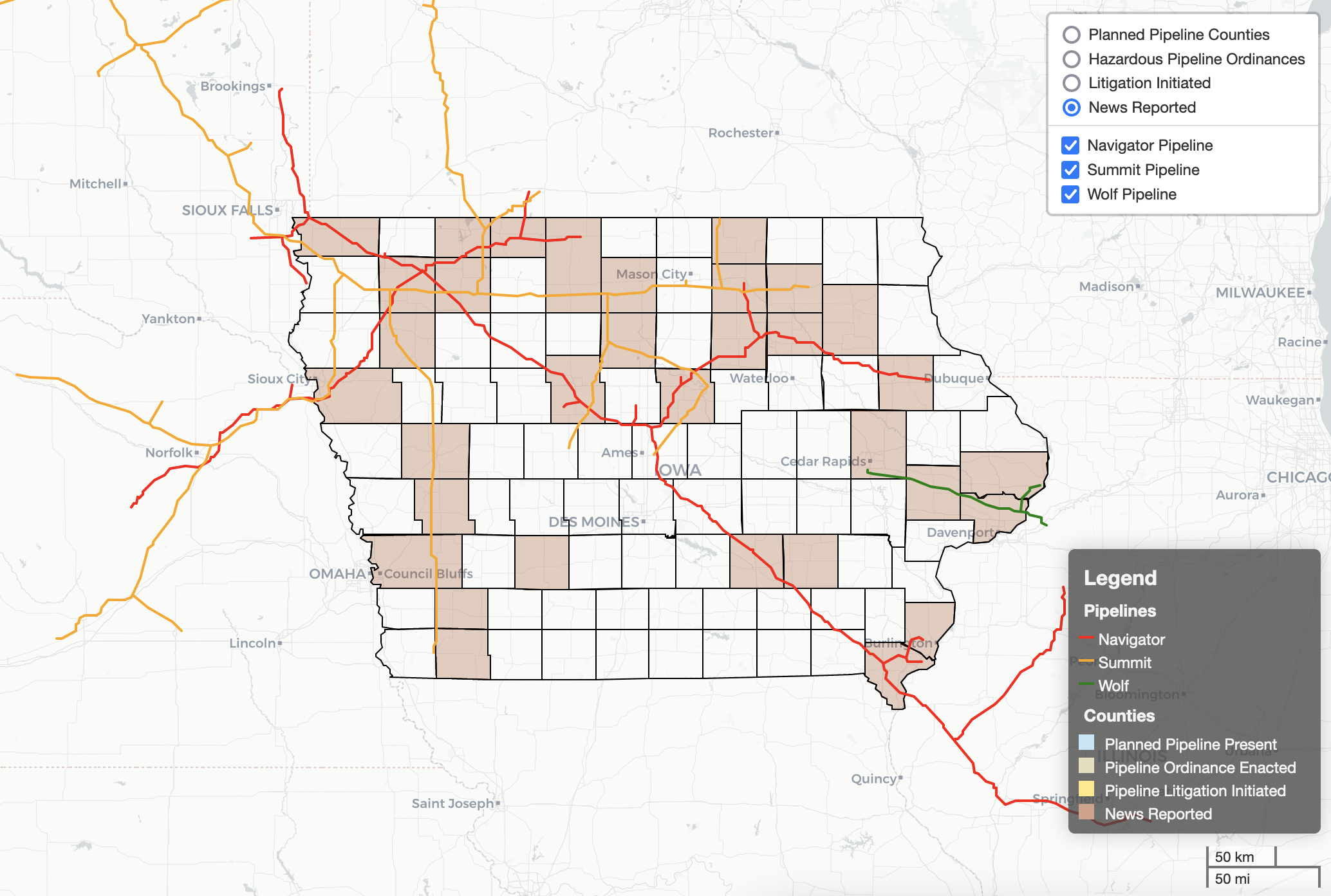
The Hubbell Environmental Law Initiative (HELI) announces the publication of a digital map to help users locate Iowa counties impacted by the proposed hazardous liquid pipelines (also known as carbon pipelines).
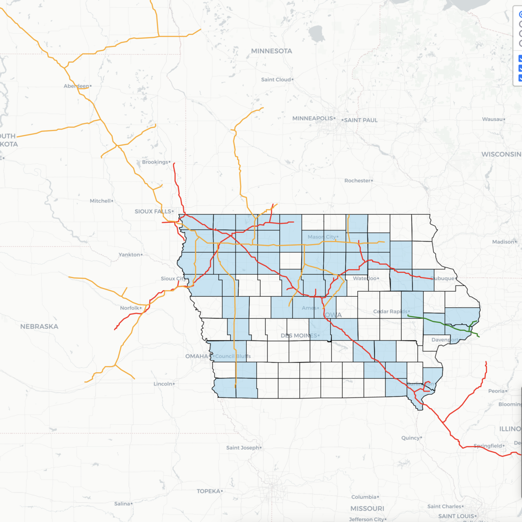
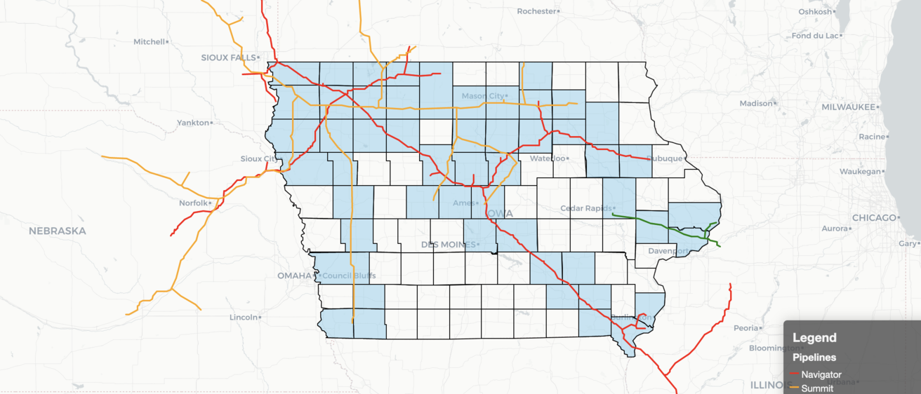
The Iowa Carbon Pipelines Digital Map details ongoing permit requests for proposed carbon pipelines in affected counties across the state of Iowa. The map project features overlays of the proposed pipeline routes through counties across the state, displayed according to the company requesting a pipeline permit through the Iowa Utilities Board. Those companies are Summit Carbon Solutions, Navigator CO₂ Ventures, and Wolf Carbon Solutions US LLC.
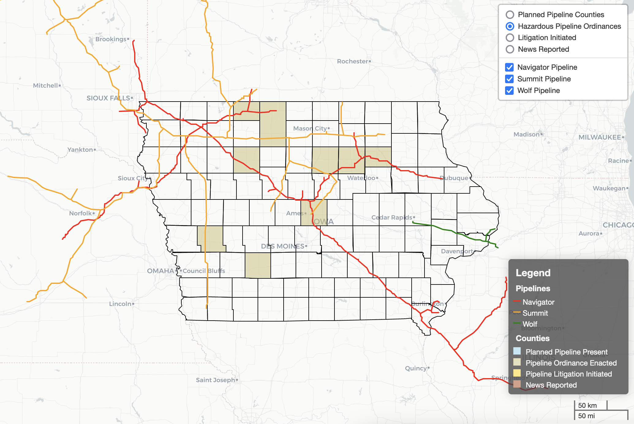
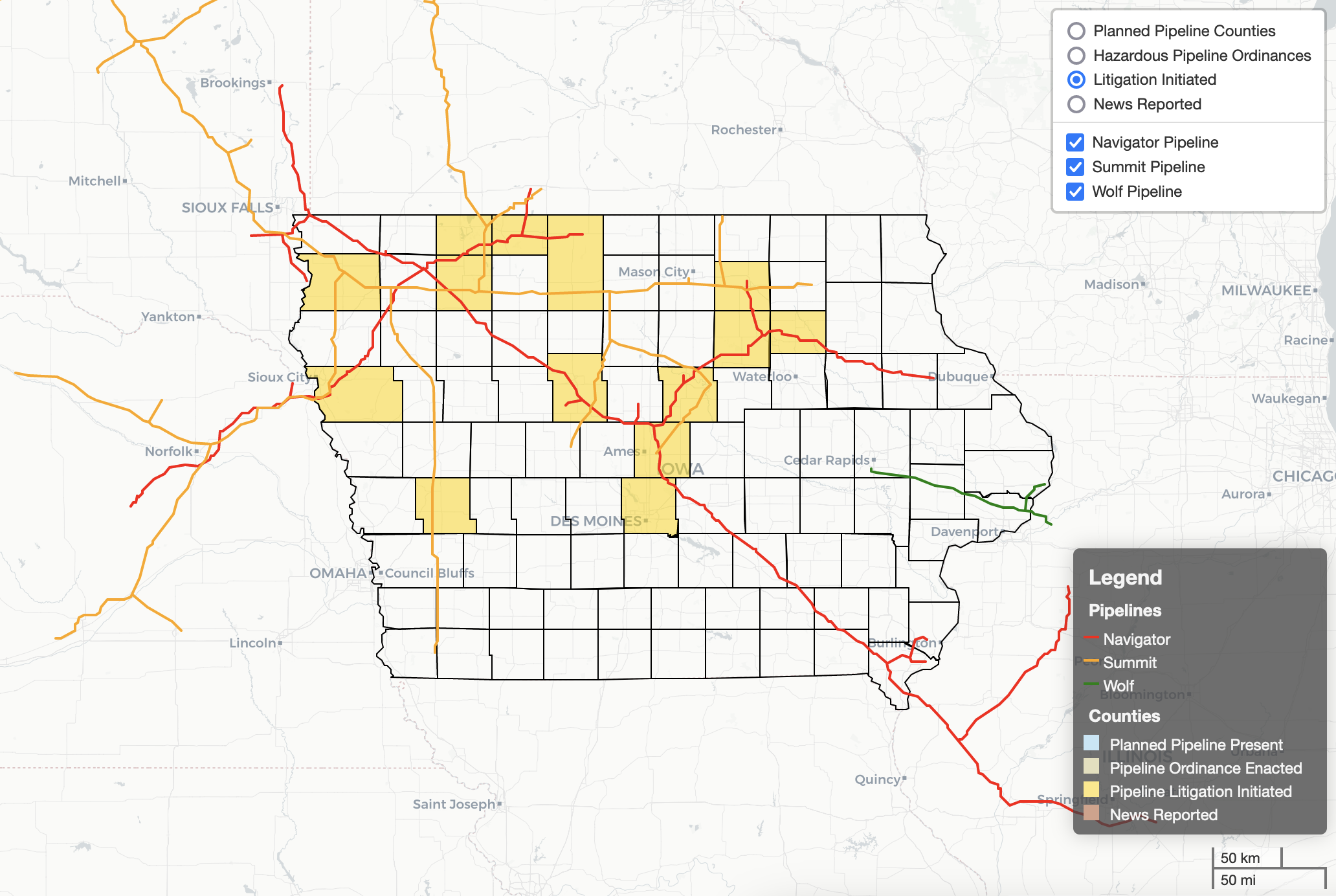
The three proposed pipeline routes are highlighted on the map so users can review relevant information about the pipeline project at the county level. Interested users can go through the Iowa Carbon Pipelines Digital Map and peruse the various features including the pipeline routes, local news stories published about the counties where the pipeline routes have been proposed, local ordinances passed in response to pipeline proposals, and litigation initiated pertaining to the routes.
Shannon Roesler, the faculty director of HELI, elaborated on these map features, stating “We hope the digital map is a useful resource for people interested in how landowners and local communities are responding to the pipeline companies’ proposals. To build these pipelines, the companies must obtain easements across private lands. The ordinances and lawsuits included in the map reflect local opposition based on land use and safety concerns, as well as private property rights.”
|
|
|
“The map, with all of its overlays, is a helpful visual representation of where these various pipeline projects are as well as the local issues arising from them, which isn’t always easy to find in these large, multi-state projects,” said Ingrid Gronstal, HELI’s research fellow. “If folks are trying to follow the projects in the IUB docket alone, it quickly becomes confusing and overwhelming. We wanted to make this important information accessible to the public.”
HELI worked together with various teams at the University of Iowa to create this map. The research team for this project included the Iowa Law Library researchers, Iowa Law Research Assistants, an undergraduate student researcher, and the HELI Research Fellow. The teams at the UI Libraries’ Digital Scholarship and Publishing Studio managed the project, created the digital map, and translated dense research onto the map itself.
Jay Bowen, geographic information system specialist at the Digital Scholarship and Publishing Studio, spoke about his work on the map: “This map is one of the timeliest projects we have worked on at the Digital Scholarship and Publishing Studio. We hope the inclusion of a searchable and filterable form alongside the interactive map will increase the accessibility of the interface. Iowans curious to know more about the carbon pipeline projects impacting their communities should not need to look much farther.”
The Iowa Carbon Pipelines Digital Map is an ongoing project which will be updated as the permit process continues to unfold across the state of Iowa and larger Midwest region.
For questions or suggestions about the map, contact Blake Rupe at blake-rupe@uiowa.edu.
The map creators would like to generously thank the FracTracker Alliance for making their digitized pathways of the proposed pipelines publicly available. Without these, the speedy rollout of this map would have been significantly hampered.